PVHA Watsonville and Pajaro Valley Map Collection
Sanborn Map Co. & Atlas of SC County (1)
Santa Cruz Maps
Item
Main Area Served: Watsonville City
Title or Main Entry Subject: Sanborn Map Co.
Type: Buildings & Streets
Scale: 1” = 50 ft.
Date: 1873
Size: 22” x 25”, 2 sheets
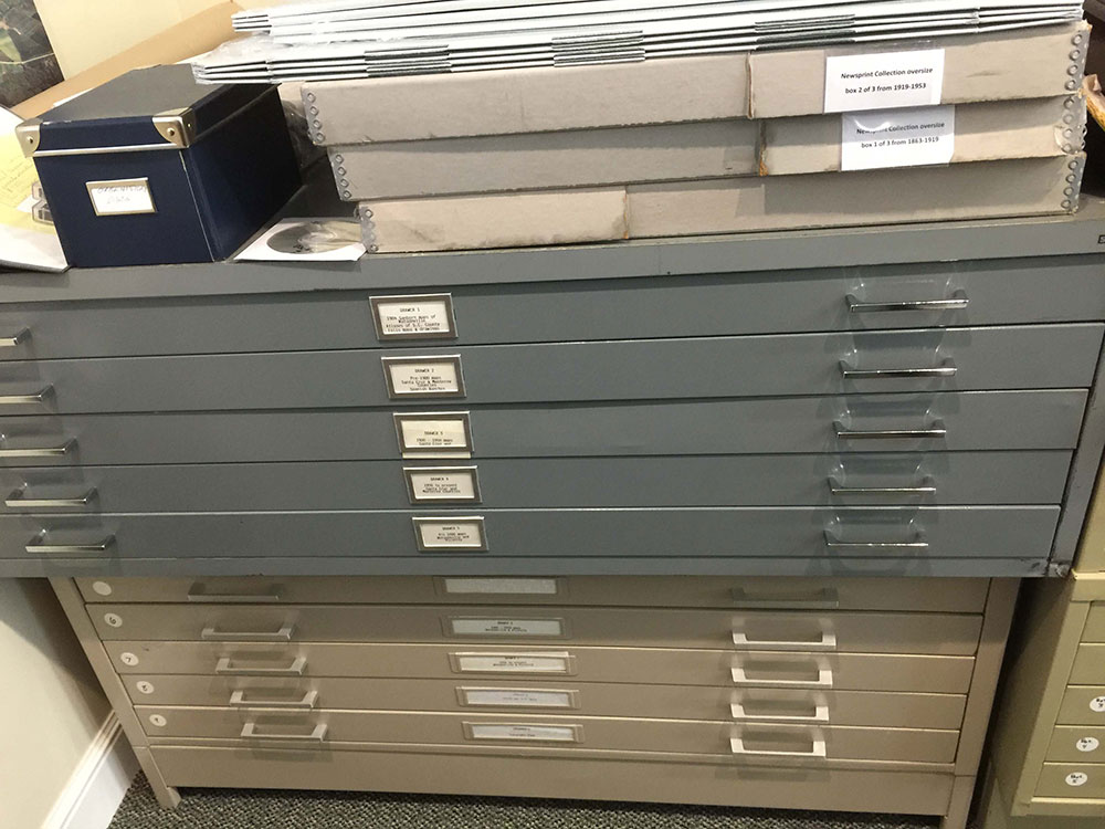
Storage Location: Drawer 1
Accession #: 77.6.1a, b
Item
Main Area Served: Watsonville, Corralitos, Pajaro
Title or Main Entry Subject: Sanborn Map Co.
Type: Shows all Buildings & Streets
Scale: 1” = 50ft
Date: 1902
Size: 22” x 25”, 23 sheets
Storage Location: Drawer 1
Accession #: 86.7.12
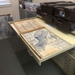
Item
Main Area Served: Santa Cruz County
Title or Main Entry Subject: Atlas of Santa Cruz County
Type: Shows all land parcels
Scale: Varied
Date: 1929
Size: 18” x 24”, 60 map sheets
Storage Location: Drawer 1
Accession #: 52.5.1
Item
Main Area Served: Santa Cruz County
Title or Main Entry Subject: Atlas of Santa Cruz County
Type: Shows all land parcels
Scale: Varied
Date: 1941
Size: 18” x 24”, 35 sheets, incomplete
Storage Location: Drawer 1
Accession #: m1994.1.13
DRAWER 2, Pre-1900 Maps of Santa Cruz and Monterey Counties
Pre-1900 Maps of Santa Cruz and Monterey Counties (2)
Map Pajaronian
Item
Main Area Served: Monterey Bay
Title or Main Entry Subject: Plano de la Bahia de Monterey
Type: Hand sketch, printed copy
Scale:
Date: 1825
Size: 16” x 20”
Storage Location: Drawer 2
Accession #: M1994.1.17
Item
Main Area Served: Southwestern United States
Title or Main Entry Subject: Map of Texas and the Countries Adjacent to Pacific Ocean
Type: Land sketch map for State Department
Scale: 150 +/- miles to 1 inch
Date: 1844
Size: 11” x 17”
Storage Location: Drawer 2
Accession #: 71.18.9
Item
Main Area Served: Pajaro River north to Santa Clara County Line
Title or Main Entry Subject: Plot of Salsipuedes Rancho
Type: Original (?) mounted on linen, rolled on scroll
Scale: 40 chains to 1 inch
Date: 1857-58
Size: 22” x 26”
Storage Location: Drawer 2
Accession #: 71.11.1
Item
Main Area Served: Pajaro River north to Santa Clara Line
Title or Main Entry Subject: Plot of Salsipuedes Rancho
Type: Black and white copy of rolled original
Scale: 40 chains to 1”, reduced copy
Date: 1857-58
Size: 22” x 26”, 9” x 10”
Storage Location: Drawer 2
Accession #: 88.8.3a, b, c, d, e
Item
Main Area Served: Aptos
Title or Main Entry Subject: Plot of Aptos Rancho
Type: Copy and dinner map from Hotel Bayview
Scale: 40 chains to 1 inch
Date: 1858
Size: 16” x 20”, 12” x 18”
Storage Location: Drawer 2
Accession #: M1994.1.15a, b
Item
Main Area Served: Adjacent to and north of Pajaro River
Title or Main Entry Subject: Plot of Rancho Bolsa del Pajaro
Type: copy
Scale: 20 chains to 1 “
Date: 1858
Size: 20” x 25”
Storage Location: Drawer 2
Accession #: 1994.1.14
Item
Main Area Served: Near Pajaro River, San Juan Road
Title or Main Entry Subject: Plot of Canada de la Carpenteria
Type: Velum copy and print
Scale: 20 chains to 1”
Date: 1859
Size: 18” x 25”
Storage Location: Drawer 2
Accession #: M1994.1.20a, b
Item
Main Area Served: Monterey County, just south of Pajaro River
Title or Main Entry Subject: Plot of Los Carneros Rancho
Type: Velum copy and print
Scale: 40 chains to 1””
Date: 1859
Size: 18” x 24”
Storage Location: Drawer 2
Accession #: 1994.1.21a,b, Notes: There are two different Rancho Los Carneros in area.
Item
Main Area Served: Monterey County just south of Pajaro River
Title or Main Entry Subject: Plot of Rancho Vega del Rio del Pajaro
Type: Poor blue-line copy
Scale: 20 chains to 1 inch
Date: 1859
Size: 20” x 24”
Storage Location: Drawer 2
Accession #: 1994.1.22
Item
Main Area Served: Vicinity of Aromas
Title or Main Entry Subject: Folio and plot of Rancho Los Carneros
Type: Original or very early copy
Scale: 20 chains to 1 inch
Date: 1859
Size: 13” x 17”
Storage Location: Drawer 2
Accession #: 72.7.22a, b, c
Item
Main Area Served: Mainly Monterey County south of Pajaro River
Title or Main Entry Subject: Land plots of Rancho Bolsa de San Cayetano
Type: Black and white copies
Scale:
Date: 1859, 1908
Size: 11” x 13”, 11” x 15”
Storage Location: Drawer 2
Accession #: 89.15.4, 89.15.5
Item
Main Area Served: San Andreas on Monterey Bay
Title or Main Entry Subject: Plot of San Andreas Rancho with copies of hand-drawn originals
Type: Blue line and black and white
Scale: 40 chains to 1 inch
Date: 1860 & earlier
Size: 21” x 24 “and reduced
Storage Location: Drawer 2
Accession #: 1994.1.18a, b, c
Item
Main Area Served: Corralitos Area
Title or Main Entry Subject: Plot of Rancho de Los Corralitos
Type: Various copies
Scale: 40 chains to 1 inch, or reduced
Date: 1860, 1866
Size: 10” x 14”, 18” x 25”
Storage Location: Drawer 2
Accession #: 89.2.1, 1995.69.1
Item
Main Area Served: Calabasas - Corralitos
Title or Main Entry Subject: Plot of Rancho Laguna de las Calabasas
Type: Blue-line copy
Scale: 20 chains to 1 inch
Date: 1868
Size: 18” x 24”
Storage Location: Drawer 2
Accession #: 1994.1.19
Item
Main Area Served: Santa Cruz County and Pajaro Township
Title or Main Entry Subject: Ownership map with enlargement of Pajaro Township
Type: Black and white copy
Scale:
Date: 1889
Size: 8” x 11”, 18” x 20”
Storage Location: Drawer 2
Accession #: 89.47.2, 89.47.3
Item
Main Area Served: Casserly Area
Title or Main Entry Subject: Land plot of Mc Grath’s Mountain Farm
Type: Black and white copy
Scale: 10 chains to 1 inch
Date: pre 1900
Size: 11” x 17” (2 sheets)
Storage Location: Drawer 2
Accession #: 87.25.1a, b
DRAWER 3, 1900-1950 Santa Cruz and Monterey Counties
Item
Main Area Served: North Monterey County
Title or Main Entry Subject: Map of Spanish land grant and land ownership
Type: Copy, untitled in any way
Scale: unknown
Date: Early 1900’s (unmarked)
Size: 27"x32"
1900-1950 Santa Cruz and Monterey Counties (3)
More Maps
Storage Location: Drawer 3
Accession #: M1994.1.23
Item
Main Area Served: Santa Cruz Co-Beach area- mouth of Pajaro River
Title or Main Entry Subject: Subdivision Map of Port Watsonville
Type: Copy of Original
Scale: Unknown
Date: 1903
Size: 8 1/2"x11"
Storage Location: Drawer 3
Accession #: 1994.82.1
Item
Main Area Served: Santa Cruz County
Title or Main Entry Subject: Co. of Santa Cruz showing Land Grants and other property ownership
Type: Blueline copies
Scale: 1 inch=50chains
Date: 1906
Size: 26"x36"
Storage Location: Drawer 3
Accession #: M1994.1.24 a, b
Item
Main Area Served: Parts of Santa Cruz, Monterey & San Benito Co.
Title or Main Entry Subject: Map of the Pajaro Valley
Type: Shows land ownership
Scale: 1 inch to 40 chains
Date: 1908
Size: 26"x31"
Storage Location: Drawer 3
Accession #: 89.5.53a, b, c, d, e,
92.1.422 a
Item
Main Area Served: Santa Cruz County
Title or Main Entry Subject: 1910 School sites in parts of Santa Cruz County
Type: Plotted on a base map
Scale: 1inch=1/2 mile
Date: 1910 schools, 1971 base
Size: 26"x36" folded
Storage Location: Drawer 3
Accession #: 81.45.3
Item
Main Area Served: Santa Cruz County
Title or Main Entry Subject: Road Map of Santa Cruz County
Type: Ranchos, section, township, ad range
Scale: 1 inch=2mile
Date: 1913
Size: 17"x22"
Storage Location: Drawer 3
Accession #: 72.27.10.80.19.24
Item
Main Area Served: Central California
Title or Main Entry Subject: Maps of Coast Division of Southern Pacific Railroad
Type: Copy
Scale: 1 inch =2-4miles
Date: 1915
Size: 9"x14"
Storage Location: Drawer 3
Accession #: M1994.1.30
Item
Main Area Served: Santa Cruz County
Title or Main Entry Subject: Denny's pocket map of Santa Cruz County
Type: Published, as a folded pocket map
Scale: 1 unit=2miles
Date: 1916
Size: 20"x29"
Storage Location: Drawer 3
Accession #: M1994.128a, b
Item
Main Area Served: Near Watsonville
Title or Main Entry Subject: Map of the Rodgers Farm
Type: Shows farm buildings and tress planted
Scale: 1 inch to 100 feet
Date: 1916
Size: 22"x34"
Storage Location: Drawer 3
Accession #: M1994.1.27
Item
Main Area Served: Larkin Valley Area
Title or Main Entry Subject: Map of Part of lot #1, San Andres Rancho
Type: Copied from Johnston title as abstract
Scale: unknown
Date: 1920
Size: 8 1/2"x11"
Storage Location: Drawer 3
Accession #: M1994.1.26
Item
Main Area Served: Southern Santa Cruz County
Title or Main Entry Subject: U.S. Soil Erosion Service, Corralitos Project Index Map
Type: Shows land ownership & some cultural features
Scale: 1inch=2,000feet
Date: 1934
Size: 36"x46"
Storage Location: Drawer 3
Accession #:
Item
Main Area Served: North Monterey County
Title or Main Entry Subject: Map of Salinas City and Vicinity
Type: Published as a folded pocket map
Scale: 1 inch to 2 miles
Date: 1938
Size: 22"x28"
Storage Location: Drawer 3
Accession #: M1994.1.29
Item
Main Area Served: Monterey Bay Area
Title or Main Entry Subject: Chamber of Commerce Maps of Monterey Bay District
Type: Printed colored copies (8 total)
Scale: unknown
Date: 1930-1940's
Size: 8 1/2"x11"
Storage Location: Drawer 3
Accession #: 93.29.10.92.12.1a, b, c, d, e, f, 98.35.16
Item
Main Area Served: Monterey Bay Area
Title or Main Entry Subject: Chamber of Commerce Maps of Monterey Bay District
Type: Printed colored copies (8 total)
Scale: Unknown
Date: 1930's-1940's
Size: 8 1/2"x11"
Storage Location: Drawer 3
Accession #: 93.35.16
93.29.10
92.12.1a, b, c, d, e, f
Notations on Reverse: Maps printed on back side of Watsonville Chamber of Commerce Stationary. No dates on maps but letters are dated from 1931 to 1947.
Item
Main Area Served: Watsonville Area along Corralitos
Title or Main Entry Subject: Map of Bronson lands, part of Rancho Corralitos and Rancho Bolsa del Pajaro
Type: Blue Print and copy
Scale: 1 inch=200feet
Date: 1940
Size: 18"x26"
Storage Location: Drawer 3
Accession #: M.1994.1.25
Item
Main Area Served: Santa Cruz- Santa Clara Counties
Title or Main Entry Subject: Map of Mt. Madonna Co. Park
Type: Copy and reduced copy
Scale: 1 inch=710 feet
Date: 1941
Size: 17"x21" & reduced
Storage Location: Drawer 3
Accession #: 89.47.110
Item
Main Area Served: Santa Cruz County
Title or Main Entry Subject: Road map of the county of Santa Cruz
Type: Published, office of county surveyor
Scale: 1 unit=2 miles
Date: 1942
Size: 17"x22"
Storage Location: Drawer 3
Accession #:93.29.3
Item
Main Area Served: Monterey County
Title or Main Entry Subject: Subdivision map of Springfield Park No. 1
Type: Lot subdivision next to Struve Road, copy
Scale: 1 inch to 100 feet
Date: 1946
Size: 16"x24"
Storage Location: Drawer 3
Accession #: 92.1.734
Item
Main Area Served: Monterey County
Title or Main Entry Subject: Deed survey, Casa Materna Vallejos Adobe (Glass House Adobe)
Type: Blueline ad wrong copy
Scale: 1 inch to 100 feet
Date: 1947
Size: 18"x26"
Storage Location: Drawer 3
Accession #: 93.44.4a, b
Notations on Reverse: Across the road from Watsonville Golf and Country Club
Item
Main Area Served: Southern Santa Cruz County
Title or Main Entry Subject: Foothill Firefighters
Type: Hand Sketched
Scale: unknown
Date: 1947-48
Size: 32"x54"
Storage Location: Drawer 3
Accession #: 2000.13.1
DRAWER 4, 1950 to Present Santa Cruz and Monterey Counties
Item
Main Area Served: Santa Cruz County
Title or Main Entry Subject: Road map of Santa Cruz County
Type: Copy
Scale: 1"=2miles
Date: 1955
Size: 15"x20"(2 copies)
Storage Location:
Accession #: 94.1.33a, b
Item
Main Area Served: Santa Cruz County Watsonville Area, Thompson Road
Title or Main Entry Subject: County Assessors Maps No. 110-11 and 12
Type: Copy of Bernice Porter's originals
Scale: Unknown
Date: 1955
Size: 8 1/2"x11"
1950 to Present Santa Cruz and Monterey Counties (4)
Last Maps
Storage Location: Drawer 4
Accession #: 87.25.3
87.25.2
Item
Main Area Served: Santa Cruz County
Title or Main Entry Subject: Map of City and County of Santa Cruz
Type: Published
Scale: Unknown
Date: 1959
Size: 17"x22"
Storage Location: Drawer 4
Accession #: 94.1.43
Item
Main Area Served: Santa Cruz County
Title or Main Entry Subject: County General Plan for 1985
Type: Zoning map: Agricultural, Residential, Commercial
Scale: 1"=1mile
Date: 1960
Size: 23"x35"
Storage Location: Drawer 4
Accession #: 2001.14.3
Item
Main Area Served: Santa Cruz County
Title or Main Entry Subject: Road Map of Santa Cruz County
Type: Printed
Scale: 1"=2 1/2miles
Date: C-1960
Size: 20"x23" 2 copies
Storage Location: Drawer 4
Accession #: 94.35a, b
Notations on Reverse: Shows route of 4th of July road race
Item
Main Area Served: Santa Cruz County
Title or Main Entry Subject: County assessor’s Maps, san Andreas Rancho Area
Type: 21 sheets copied from County Assessors Book
Scale: Unknown
Date: 1951&1961 to 1969
Size: 11"x17"
Storage Location: Drawer 4
Accession #: 90.6.13a to 90.6.13w inclusive
Item
Main Area Served: Santa Cruz County
Title or Main Entry Subject: Santa Cruz County Fairgrounds Proposal
Type: Hand drawn with water colors
Scale: 1"=20ft
Date: 1967
Size: 28"x40"
Storage Location: Drawer 4
Accession #: 67.52.1
Item
Main Area Served: North off Pajaro River, Santa Cruz and Monterey Counties
Title or Main Entry Subject: Aerial photo Beach Road and Pajaro River
Type: Print of aerial photo
Scale: Unknown
Date: 1968
Size: 26"x40"
Storage Location: Drawer 4
Accession #: 89.47.9
Item
Main Area Served: Santa Cruz County
Title or Main Entry Subject: Aptos, Corralitos and Watsonville Area
Type: Hand-drawn, poster type map
Scale: Unknown
Date: 1970's
Size: 18"x28"
Storage Location: Drawer 4
Accession #: 94.1.36
Item
Main Area Served: Santa Cruz County
Title or Main Entry Subject: Parks, Recreation and Open Space Plans
Type: Land use map, printed in color
Scale: 1=1mile
Date: c-1970
Size: 21"x36"
Storage Location: Drawer 4
Accession #: 94.1.38
Item
Main Area Served: Monterey County
Title or Main Entry Subject: Map showing Supervisorial Districts of Monterey Co.
Type: Copy
Scale: Unknown
Date: 1971
Size: 23"x36" (folded)
Storage Location: Drawer 4
Accession #: 94.1.34
Item
Main Area Served: Santa Cruz County
Title or Main Entry Subject: Map of Santa Cruz Supervisorial Districts
Type: Copy (incomplete)
Scale: Unknown
Date: 1971
Size: 11"x17"
Storage Location: Drawer 4
Accession #: 94.1.42
Item
Main Area Served: North Monterey County
Title or Main Entry Subject: Road Map of North Monterey County
Type: Copied From Larger Map
Scale: Unknown
Date: 1975
Size: 19"x14"
Storage Location: Drawer 4
Accession #: 88.5.16c
Item
Main Area Served: Santa Cruz and Monterey Counties
Title or Main Entry Subject: Map of Land Grants, Santa Cruz & Monterey Counties
Type: Copied from County Surveyors Office by Alzora Snyder
Scale: Unknown
Date: 1975
Size: 30"x34" (folded)
Storage Location: Drawer 4
Accession #: 94.1.32
Item
Main Area Served: NE Monterey County, Aromas Area
Title or Main Entry Subject: Monterey County, zoning Plans, Selection 10-10B
Type: Copy
Scale: Unknown
Date: 1975
Size: 8-1/2"x11"
Storage Location: Drawer 4
Accession #: 88.5.16a
Item
Main Area Served: North Monterey County
Title or Main Entry Subject: North Monterey County Ag. Map
Type: Shows property ownership, copy
Scale: 2"=1mile
Date: 1979
Size: 11"x14"
Storage Location: Drawer 4
Accession #: 88.5.16b
Item
Main Area Served: Santa Cruz County
Title or Main Entry Subject: City and Supervisorial Boundaries
Type:
Scale: 1"=1mile
Date: 1970’s-1980's
Size: 30"x42"
Storage Location: Drawer 4
Accession #: 98.17.16
Item
Main Area Served: Monterey County
Title or Main Entry Subject: North Monterey County Planning Details
Type: Ozalid copy
Scale: 1"=400ft
Date: 1982
Size: 30"x40"
Storage Location: Drawer 4
Accession #: 1994.3.71
Item
Main Area Served: Santa Cruz and Monterey Counties
Title or Main Entry Subject: Boundaries of proposed Pajaro Valley Water Management District
Type: Copy
Scale: Unknown
Date: c-1984
Size: 8 1/2"x 11"
Storage Location: Drawer 4
Accession #: 84.39.1
Item
Main Area Served: Santa Cruz County
Title or Main Entry Subject: Maps of Districts in Pajaro Valley School System
Type: Copy
Scale: Unknown
Date: 1986
Size: 20"x40" (folded)
Storage Location: Drawer 4
Accession #: 86.67.3
Item
Main Area Served: South Santa Cruz CO. Communities
Title or Main Entry Subject: Gilroy, Morgan Hill, Coyote
Type: CSAA
Scale: 1"=2,200ft
Date: 1998
Size: 36"x 24"
Storage Location: Drawer 4
Accession #:
Item
Main Area Served: South Santa Cruz County
Title or Main Entry Subject: Ag. Com. Co. Ranch Maps
Type: Bound booklet
Scale: Unknown
Date: 1997, 1999
Size: about 11"x17" and 9"x14"
Storage Location: Drawer 4
Accession #: 1997.14
DRAWER 5, Pre 1900 Watsonville and vicinity
Item
Main Area Served: Watsonville and vicinity
Title or Main Entry Subject: Map of the town Watsonville & NE part of Rancho Bolsa del Pajaro
Type: Shows streets and property ownership
Scale: Rancho 10 chains to inch, Town 200 feet to inch and reduced
Date: 1860
Size: 29"x32" (4 copies including encapsulated original)
Topographic and Geologic Maps (9)
Storage Location: Drawer 5
Accession #: 73.12.1 a, b, c, d
85.24.22
Item
Main Area Served: Watsonville and Vicinity
Title or Main Entry Subject: Map of Watsonville & part of Bolsa Del Pajaro
Type: Shows streets and property ownership
Scale: 1 inch=200feet
Date: 1865
Size: 26"x35" (4 copies of various types)
Storage Location: Drawer 5
Accession #: 85.24.27 a, b, c, d
Item
Main Area Served: City of Watsonville
Title or Main Entry Subject: Birds Eye View of Watsonville
Type: Prospective drawing showing buildings
Scale: Unknown
Date: 1875
Size: 20"x24" (8 copies, including 2 original lithographs)
Storage Location: Drawer 5
Accession #: 66.1.2 a, b, c, d, e, f
85.24.21
Item
Main Area Served: City of Watsonville
Title or Main Entry Subject: Prospective drawing of Watsonville with Drawings of important buildings around it.
Type: Original lithograph and copies
Scale: Unknown
Date: 1898
Size: 20"x27"(and reduced size 3 copies)
Storage Location: Drawer 5
Accession #: 71.1.1 amebic
Item
Main Area Served: City of Watsonville
Title or Main Entry Subject: Map of the City of Watsonville
Type: Shows streets, lots and lot ownership
Scale: unknown
Date: Pre 1900(?)
Size: 30"x36"
Storage Location: Drawer 5
Accession #: 94.1.44
DRAWER 6, 1900-1950 Watsonville and vicinity
Item
Main Area Served: Watsonville
Title or Main Entry Subject: Street map of Watsonville
Type: Old original (9 copies)
Scale: 1inch=600feet
Date: 1901
Size: 11"x15" (7 copied originals)
Storage Location: Drawer 6
Accession #: 99.12.58
92.70.1 a, f, g, h
Item
Main Area Served: Watsonville
Title or Main Entry Subject: Construction plans, Watsonville Library by Weeks
Type: 5 sheets, reverse reading, white on black
Scale: Unknown
Date: 1905
Size: 19"x18"
Storage Location: Drawer 6
Accession #: 94.1.48 a, b, c, d, e
Item
Main Area Served: Watsonville, Main & High Street Area
Title or Main Entry Subject: Buena Vista Heights-Adamson Subdivision map
Type: Blue line copy
Scale: 1"=50'
Date: 1911
Size: 36"x39"
1900-1950 Watsonville and vicinity (6)
Storage Location: Drawer 6
Accession #: 94.1.45
1995.7.9
Item
Main Area Served: Watsonville, Rodriguez Street area
Title or Main Entry Subject: Subdivision map of lots, 5th, 6th, and Rodriguez
Type: Hand drafted on linemen
Scale: Unknown
Date: 1912
Size: 11"x14"
Storage Location: Drawer 6
Accession #: 79.22.2
Item
Main Area Served: Watsonville
Title or Main Entry Subject: Map of Watsonville, showing property ownership
Type: Printed originals (2)
Scale: 1"=200'
Date: c-1914
Size: 12"x16" (1 copies in 6 pieces)
Storage Location: Drawer 6
Accession #: 71.19.30 a, b, c
Item
Main Area Served: Watsonville
Title or Main Entry Subject: Japanese and Chinese residential & business areas, Watsonville and Pajaro
Type: Compiled from Sanborn maps with names added
Scale: Unknown
Date: c-1920
Size: 11"x17" (3 copies Watsonville area, 4 copies Pajaro area)
Storage Location: Drawer 6
Accession #: 93.26.20
93.26.21
Item
Main Area Served: Watsonville
Title or Main Entry Subject: Map of Watsonville Heights Subdivision No. 1
Type: Printed, Watsonville realty Co. promotion
Scale: Unknown
Date: Early 1920's
Size: 10"x16"
Storage Location: Drawer 6
Accession #: 89.5.57
Item
Main Area Served: Watsonville
Title or Main Entry Subject: Street map City of Watsonville
Type: Printed
Scale: 1'=500"
Date: 1928
Size: 17"x22"
Storage Location: Drawer 6
Accession #: 89.23.3, 2004.45.21
Item
Main Area Served: Watsonville
Title or Main Entry Subject: Map of the City of Watsonville
Type: Shows lots and land owners
Scale: Original was 1"=200'
Date: 1929
Size: 26"x44" (folded, 2 copies)
Storage Location: Drawer 6
Accession #: 52.5.1 a, b, c, d, e, f
Item
Main Area Served: Watsonville-Freedom Boulevard
Title or Main Entry Subject: Businesses along Freedom Boulevard-Enemark Store
Type: Sketch maps (3) obtained from Olga Enemark Dyke, July, 1987 by Betty Lewis
Scale: Unknown
Date: c-1930
Size: 12"x18"
Storage Location: Drawer 6
Accession #: 87.19.2 a, b, c
Item
Main Area Served: Watsonville
Title or Main Entry Subject: Street map of City of Watsonville
Type: Printed Bay Area on Back
Scale: 1 inch=500 +/- feet
Date: Pre WWII (?)
Size: 17"x 22" (3 copies, 1 mounted
Storage Location: Drawer 6
Accession #: 89.60.10 a, b, c
2000.20.135
Item
Main Area Served: Watsonville
Title or Main Entry Subject: Street map of city of Watsonville
Type: Printed, Monterey Bat Area on back
Scale: 1 inch= 500 feet
Date: Pre WWII (?)
Size: 17"x22" (2 copies)
Storage Location: Drawer 6
Accession #: 74.64.4
94.1.46 a, b
Item
Main Area Served: Watsonville
Title or Main Entry Subject: Street map of Watsonville
Type: Printed by Register-Pajaronian
Scale: Unknown
Date: Pre WWII, probably late 1930's
Size: 16"x22"
Storage Location: Drawer 6
Accession #: 86.59.19
Item
Main Area Served: Watsonville
Title or Main Entry Subject: City of Watsonville and Pajaro
Type: Shows streets and property ownership
Scale: 1inch=200feet
Date: Unknown
Size: 45"x50" (rolled on stick)
Storage Location: Drawer 6
Accession #: 1982.1.1
Item
Main Area Served: Watsonville
Title or Main Entry Subject: Street Map of City of Watsonville
Type: Printed (Watsonville Chamber of Commerce)
Scale: 1"=500'
Date: 1949
Size: 14"x17"
Storage Location: Drawer 6
Accession #: 1995.50.2
Item
Main Area Served: Watsonville
Title or Main Entry Subject: Street map of City of Watsonville
Type: Printed, Bay Area on back
Scale: 1"=500'
Date: Post WWII
Size: 17"x22" (2 copies)
Storage Location: Drawer 6
Accession #: 94.1.47 a, b
Item
Main Area Served: Watsonville
Title or Main Entry Subject: Street map of Watsonville
Type: Printed, published by the Chamber of Commerce
Scale: 1"=500'
Date: Post WWII
Size: 17"x22" (4 copies)
Storage Location: Drawer 6
Accession #: 86.59.39 a, b, c, d
Item
Main Area Served: Watsonville
Title: Watsonville City and Vicinity
Type: Standard Map Service
Scale: 1" = 1 mile
Date: 1947
Size: 28 1/2" x 22 1/2"
Storage Location: Drawer 6
Accession #: 2004.45.31
DRAWER 7, 1950 to Present Watsonville and vicinity
Item
Main Area Served: Watsonville and Vicinity
Title or Main Entry Subject: Watsonville and Vicinity Street map
Type: Printed, distributed by Chamber of Commerce
Scale: 1"=1200'
Date: 1951
Size: 14" x17" (3 copies, one a slight revision)
1950 to Present Watsonville and vicinity (7)
Storage Location: Drawer #7
Accession #: 94...1.51a, b, c
Item
Main Area Served: Watsonville and Vicinity
Title or Main Entry Subject: Watsonville and Vicinity Street Map
Type: Printed, distributed by the Chamber of Commerce
Scale: Unknown
Date: 1952
Size: 17"x22" (2 copies)
Storage Location: Drawer 7
Accession #: 2000.20.35
87.29.7a, b
Item
Main Area Served: Watsonville and Vicinity
Title or Main Entry Subject: Watsonville and Vicinity
Type: Printed, Distributed by Pajaro Valley Bank
Scale: 1"-1000"
Date: 1955
Size: 17"x22" (3 copies)
Storage Location: Drawer #7
Accession #: 80.18.3 a, b, c, d
Item
Main Area Served: Watsonville and Vicinity
Title or Main Entry Subject: Two encapsulated street maps
Type:
Scale: 1"=1 mile and 1"=1,724'
Date: 1957 and 195?
Size: 28x29 and 30x22 inches
Storage Location: Drawer #7
Accession #: 2001.14.1
2001.14.2
Item
Main Area Served: Watsonville and Vicinity
Title or Main Entry Subject: Proposed Freeway in Watsonville, Harkins Slough to
Harkins Slough Road and Rob Roy Junction to Harkins Slough
Type: Freeway design map
Scale: 1"=400"
Date: 1961 and 1964
Size: 12"x88" and 12" x46"
Storage Location: Drawer #7
Accession #: 93.34.4a, b
Item
Main Area Served: Watsonville and Vicinity
Title or Main Entry Subject: Watsonville and Vicinity Street map
Type: Printed, Distributed by Wells Fargo Bank
Scale: 1"=1000'
Date: 1963
Size: 17x22" (2 partial copies)
Storage Location: Drawer #7
Accession #: 90.1.1a, b, c
Item
Main Area Served: Watsonville and Vicinity
Title or Main Entry Subject: Watsonville and Vicinity Street map
Type: Printed, distributed by Wells Fargo Bank
Scale: 1"= 1000'
Date: 1965
Size: 17"x22"
Storage Location: Drawer #7
Accession #: 89.9.32
Item
Main Area Served: City of Watsonville
Title or Main Entry Subject: Proposed house numbering map, Watsonville
Type: Blueline copy
Scale: 1"=500'
Date: 1966
Size: 40" x60" (folded)
Storage Location: Drawer #7
Accession #: 77.10.18
Item
Main Area Served: Watsonville and Vicinity
Title or Main Entry Subject: Watsonville and Vicinity Street Map
Type: Printed, Chamber of Commerce
Scale: 1"=2000'
Date: 1967
Size: 22"x30" (3copies)
Storage Location: Drawer 7
Accession #: 2000.20.134
90.1.3a, b
Item
Main Area Served: Watsonville and Vicinity
Title: General Plan Proposed Revisions
Type: Newspaper Copy Generalized Land Use
Scale: 1" x 3000'
Date: 11-30-1971
Size: 15" x 22"
Storage Location: Drawer #7
Accession #
Item
Main Area Served: Watsonville and Vicinity
Title or Main Entry Subject: Watsonville and Vicinity Street map
Type: Printed, Chamber of Commerce
Scale: 1'=1725"
Date: 1972
Size: 22"x30" (2 copies)
Storage Location: Drawer #7
Accession #: 90.1.4a, b
85.11.576
Item
Main Area Served: Watsonville and Vicinity
Title or Main Entry Subject: Watsonville and Vicinity Street map
Type: Printed AAA road map
Scale: 1"=2000'
Date: 1973
Size: 21"x28" (originally folded)
Storage Location: Drawer #7
Accession #: 89.9.31
Item
Main Area Served: City of Watsonville
Title or Main Entry Subject: Central Downtown Redevelopment Map
Type: Shows street and business locations
Scale: Unknown
Date: 1974
Size: 24"x36" (originally folded)
Storage Location: Drawer #7
Accession #: 89.5.58
Item
Main Area Served: Watsonville and Vicinity
Title or Main Entry Subject: Watsonville and Vicinity Street map
Type: Probably Printed, Chamber of Commerce
Scale: 1"=1724'
Date: 1974
Size: 22"x30"
Storage Location: Drawer 7
Accession #: 94.1.50
Item
Main Area Served: Watsonville and Vicinity
Title or Main Entry Subject: Birds' Eye View map of City of Watsonville
Type: Shows some Streets and location of various businesses
Scale: Unknown
Date: 1974
Size: 18"x23" (3 Copies)
Storage Location: Drawer 7
Accession #: 90.1.2a, b, c
Item
Main Area Served: Watsonville and Vicinity
Title or Main Entry Subject: Street Map of Watsonville and Vicinity
Type: Lo-K-Tor Service, Printed
Scale: Unknown
Date: 1977
Size: 23"x33" (originally folded)
Storage Location: Drawer #7
Accession #: 92.80.5
Item
Main Area Served: Watsonville and Vicinity
Title or Main Entry Subject: Street map of Watsonville and Vicinity
Type: Printed, Chamber of Commerce
Scale: 1"=1640'
Date: 1978
Size: 23"x35" (originally folded)
Storage Location: Drawer 7
Accession #: 93.13.43
Notations on Reverse: Parts of Santa Cruz and Monterey Counties on back
Item
Main Area Served: Watsonville and Vicinity
Title or Main Entry Subject: Map showing SPRR, Lettuce Loading Districts
Type: Markings on partial copy of street map
Scale: Unknown
Date: 1970's or later
Size: 11"x17"
Storage Location: Drawer #7
Accession #: 90.6.356
Item
Main Area Served: Watsonville and Vicinity
Title or Main Entry Subject: Watsonville and the Pajaro Valley street map
Type: Printed, Chamber of Commerce
Scale: 1"=1700' +/-
Date: 1984
Size: 23"x 35" (originally folded)
Storage Location: Drawer #7
Accession #: 90.1.5
Notation on Reverse: Parts of Santa Cruz and Monterey Counties on back
Item
Main Area Served: Watsonville and Vicinity
Title or Main Entry Subject: Political district map, City of Watsonville
Type: Copy
Scale: 1"=600'
Date: 1989
Size: 36" x42"
Storage Location: Drawer #7
Accession #: 94.1.49a, b
Item
Main Area Served: Watsonville and Vicinity
Title or Main Entry Subject: Watsonville Map and Shopping Guide, Street and Business
Type:
Scale:
Date: 1994
Size: 16 1/2x 17 inches
Storage Location: Drawer #7
Item
Main Area Served: Watsonville and Vicinity
Title or Main Entry Subject: City of Watsonville & Surrounding Vicinity
Type: Parcels, slough, rivers and city limits
Scale: 1 1/2" = 2000' +/-
Date: 1997
Size: 22" x 17"
Storage Location: Drawer #7
Accession #
Item
Main Area Served: Watsonville and Vicinity
Title: Annexation History of Watsonville
Type: Color-coded
Scale: 3" = 0.5 miles
Date: 1868-2002
Size: 24" x 36"
Storage Location: Drawer #7
Accession #
Item
Main Area Served: Watsonville and Vicinity
Title: Watsonville City Historical Sites
Type: Color-coded
Scale: 1" = 700'
Date: 6-4-03
Size: 24" x 36"
Storage Location: Drawer #7
Accession #
Item
Main Area Served: Watsonville and Vicinity
Title: City of Watsonville
Type: Parcel and city Limits
Scale: 1" = 800"
Date: Jan. 2004
Size: 24" x 36"
Storage Location: Drawer #7
Accession #
DRAWER 8, Architectural Plans
Item
Main Area Served: Bockius-Orr House 332 East Beach St. Watsonville
Title or Main Entry Subject: Bockius-Orr House Remodel
Type: Architectural Floor Plans
Scale: 1/4" = 1'
Date: 2-12-1948
Size: 19" x 36"
Architectural Plans (8)
Storage Location: Drawer #8
Accession #
Item
Main Area Served: Watsonville High School area
Title or Main Entry Subject: Architectural, Auditorium, Administration Athletic
Type:
Scale: Various
Date: 1982 and 1991
Size: Various
Storage Location: Drawer #8
Accession #: 96.24.20
96.24.21a, b, c, d
96.24.19
Item
Main Area Served: Watsonville, Main Street
Title or Main Entry Subject: Plans and contract for Stoesser Building
Type: Architectural
Scale: Varied
Date: 1923
Size: Varied
Storage Location: Drawer #8
Accession #: 76.23.5
DRAWER 9, Topographic and Geologic Maps
Item
Main Area Served: Santa Cruz County
Title: Geologic Map of Santa Cruz County
Type: Geological Color-coded
Scale: 1" = 1 mile
Date: 1989
Size: 38" x 57"
Storage Location: Drawer #9
Accession #
Item
Main Area Served: Santa Cruz County
Title or Main Entry Subject: Topographic map of Santa Cruz County
Type: Blueline copy
Scale: 1"=1'
Date: 1973
Size: 28"x46"(2 copies)
Topographic and Geologic Maps (9)
Storage Location: Drawer #9
Accession #: 94.1.37a, b
Item
Main Area Served: Watsonville and Vicinity
Title or Main Entry Subject: Watsonville West, Watsonville East
Type: U.S.G.S. Topographic maps
Scale: 1"=2000'
Date: 1954-1955
Size: 22"x27" and 24" x 30"
Storage Location: Drawer #9
Accession #: 89.26.7.92.46.2, 94.1.41
Item
Main Area Served: Moss Landing/Prunedale and all quadrangles north and east of that.
Title or Main Entry Subject: Capitola, Chittenden, Davenport, Mt. Madonna, Loma Prieta, Soquel,
Los Gatos, Laurel, Morgan Hill
Type: U.S.G.S. Topographic Maps
Scale: 1"=2000', 1"=1mile and 1"=1,000'
Date: 1927-55
Size: 22"x27, 16"1/2x20 and 24"x37
Storage Location: Drawer #9
Accession #: 89.9.95, 94.1.31, 94.1.39, 94.1.40, 93.34.5, 2000.13.3, 2000.13.2, 2000.13.5
Item
Main Area Served: Salinas/Natividad and all quadrangles south and east of that.
Title or Main Entry Subject: Salinas, Bradley, Point Sur, Lucia, King City, Cape San Martin,
Paso Robles, New Idria, Jamesburg, Cayucos, San Simeon, Seaside, Speckles, Monterey,
Type: U.S.G.S. Topographic maps
Scale: 1"=2000' and 1"=1mile
Date: 1921-1978
Size: 22"27" and 161/2"x20"
Storage Location: Drawer #9
Accession #: 2000.13.6, 2000.13.